
Projects
Roysdon Nav Toolbox
Overview
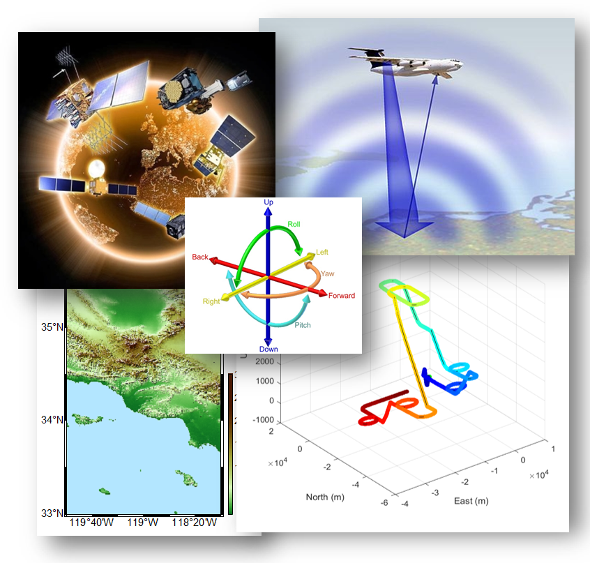
Navigation System Design, Estimation & Real-Time GNSS/INS Toolbox
The Roysdon Nav Toolbox is a state-of-the-art navigation engineering environment, built around optimal estimation theory and real-world sensor behavior. (*)
This toolbox supports centimeter-level navigation, full INS/GNSS mechanizations, and real-time embedded systems used for ground truth generation and deployed navigation stacks.
What It Enables
- Design and validation of INS, GPS, GNSS, and multi-sensor navigation systems
- Industry-grade Bayesian estimation and smoothing
- Full sensor-error modeling and observability analysis
- Transition from simulation to real-time embedded navigation
Toolboxes
Simulation & Analysis
- AHRS State Estimation is a complete implementation of an attitude heading and reference system.
- Allan Variance is a complete implementation of an Allan-Variance analysis.
- Baro Temporal Propagation & State Estimation is a complete implementation of a baro-altitude temporal propagation algorithm.
- Covariance Analysis is a complete implementation of a covariance analysis to select parameters to estimate in a state estimation filter.
- Full-nonlinear Optimal Bayesian State Estimation (Software & GUI) is a complete GPS-aided INS nav that implements a state-of-the-art full-nonlinear optimal Bayesian navigation system. This system is highly flexible with selectable states (GPS loosely-coupled, GPS tightly-coupled, GPS single-differencing, GPS double-differencing, baro-aiding), selectable initialization modes, selectable mechanization (NED, wander-azimuthm, ECEF, ECI), and IMU errros (bias, scale factor, quantiization)
- Trajectory Smoother & State Estimation this tool performs a full nonlinear optimization to smooth a trajectory using INS and GPS to an accuracy of 1 meter in position.
- Trajectory Smoother& State Estimation with Integers this tool performs a full nonlinear optimization to smooth a trajectory using INS and L1/L2 GPS to an accuracy of 1 centimeter in position. This is used for generating ground-truth in my scientific publications.
- EKF GPS State Estimation is a complete implementation of an extended Kalman filter (EKF) for a GPS receiver with selectable 5, 8, and 11-states.
- EKF GPS-INS State Estimation is a complete implementation of an EKF for a GPS-aided inertial navigation system (INS). This system is highly flexible with selectable states (GPS loosely-coupled, GPS tightly-coupled, GPS single-differencing, GPS double-differencing, baro-aiding), selectable initialization modes, selectable mechanization (NED, wander-azimuthm, ECEF, ECI), and IMU errros (bias, scale factor, quantiization).
- EKF IMU zero-update is a complete implementation of an EKF performing zero-updates (velocity or angular rate) of an IMU. This is used to evaluate the real-time performance of IMU accel-bias and gyro-bias parameters.
- GPS Positioning & State Estimation is a complete implementation of GPS positioning system using pseudo-range, doppler and phase on both L1 and L2 frequencies for precise positioning.
- IMU Coning & Sculling calculates the coning and sculling errors of an IMU.
- IMU Divergence evaluates the divergence and covariance of several different grades of IMU’s.
- INS Alignment is a complete implementation of INS alignment routines.
- INS Error Comparison evaluates the errors of several different grades of IMU’s.
- INS Error Sensitivity evaluates the error sensitivity of several different grades of IMU’s given a trajectory.
- INS Temporal Propagation is a complete implementation of an INS temporal propagation algorithm in with selectable mechanization (NED, wander-azimuthm, ECEF, ECI).
- Mag Calibration is a complete implementation of a 3-axis magnetometer calibration.
- Mag Temporal Propagation & State Estimation is a complete implementation of a 3-axis magnetometer temporal propagation.
- Monte Carlo is a complete MonteCarlo analysis toolbox for evaluating EKF and CRT performance.
- ReFrame GUI is a GUI to load attitude data from a .CSV and transform the reference frame from NED to ECEF or ECI. This is used for visual inspection of robotics data with an unknown reference frame definition.
- Signal Generator is a complete implementation of a 3DOF/6DOF trajectory generator and a signal generator for several sensors (GPS, IMU, baro, mag, sonar, radar, and signals of opportunity).
- 3DOF/6DOF Trajectory Generator is a complete implementation of a trajectory generator for both air and land vehicles. This tool implements both a kinematics model capable of any trajectory, and an F-16 6DOF model capable of advanced aerial profiles with realistic autopilot feed-back loops (this uses the NASA F-16 6DOF model parameters).
- Real-time Kinematic (RTK) GNSS is a complete implementation of an Real-time Kinematic (RTK) GNSS toolbox that leverages multiple GNSS constellations and solves L1/L2 integer ambiguity for centimeter-level ground truth.
Real-time Software
- CRT-LSS Nav (Software & GUI) is a complete GPS-aided INS nav that implements a state-of-the-art full-nonlinear optimal Bayesian navigation system. This system is highly flexible with selectable states (GPS loosely-coupled, GPS tightly-coupled, GPS single-differencing, GPS double-differencing, baro-aiding), selectable initialization modes, selectable mechanization (NED, wander-azimuthm, ECEF, ECI), and IMU errros (bias, scale factor, quantiization)
- Data Acquisition System (Software & GUI) is a complete implementation of data acquisition system with GPS, IMU, Mag, and 20 A2D channels.
- RTK (Software & GUI) is a complete implementation of a real-time kinematic GPS positioning system using both a base station and rover for 1 cm level positioning.
Data Parsers
- Data Parser CRT-LSS parses the binary messages generated from real-time CRT navigation system.
- Data Parser NovAtel parses the binary messages generated from a real-time NovAtel GPS system.
- Data Parser uBlox parses the binary messages generated from a real-time uBlox GPS system.
(*) This repo is a collection of tools from my personal research and publications.